In the beginning…
Before the Constitution was drafted in 1787, the governing body was called the Continental Congress. This Congress had no permanent home – instead it would meet in different cities, depending on the year.
Knowing that eventually there would be a need for a permanent capital, the drafters of the Constitution gave the brand new Congress the power to choose a site for the new capital at some time in the future.

1790 - The Residence Act
Three years after the Constitution was written, Thomas Jefferson, Alexander Hamilton and James Madison came up with a plan: (Jefferson was Sec. of State, Hamilton was Sec. of Treasury and Madison was a Senator from Virginia). Hamilton would round up votes from the northern states for a southern capital if Madison would round up southern votes for Hamilton’s bank plan. This agreement became known as the Compromise of 1790 and it resulted in Congress passing the Residence Act of 1790.
The Residence Act of 1790 provided for the establishment of a national capital somewhere on the eastern bank of the Potomac River – the exact site to be chosen by President George Washington.
Choosing the location
Why on the Potomac?
The Potomac River was an acceptable choice for both the northern states and southern states. It was considered the south, but was the northernmost river in the south. And it was thought at the time that the Potomac River would open up western regions of the new country to commerce and trade. The fact that President George Washington had his home on the river was not overlooked.
Why have George Washington choose the location?
George Washington knew the river well and believed that the Potomac would become the major commercial route for commerce in this new country.

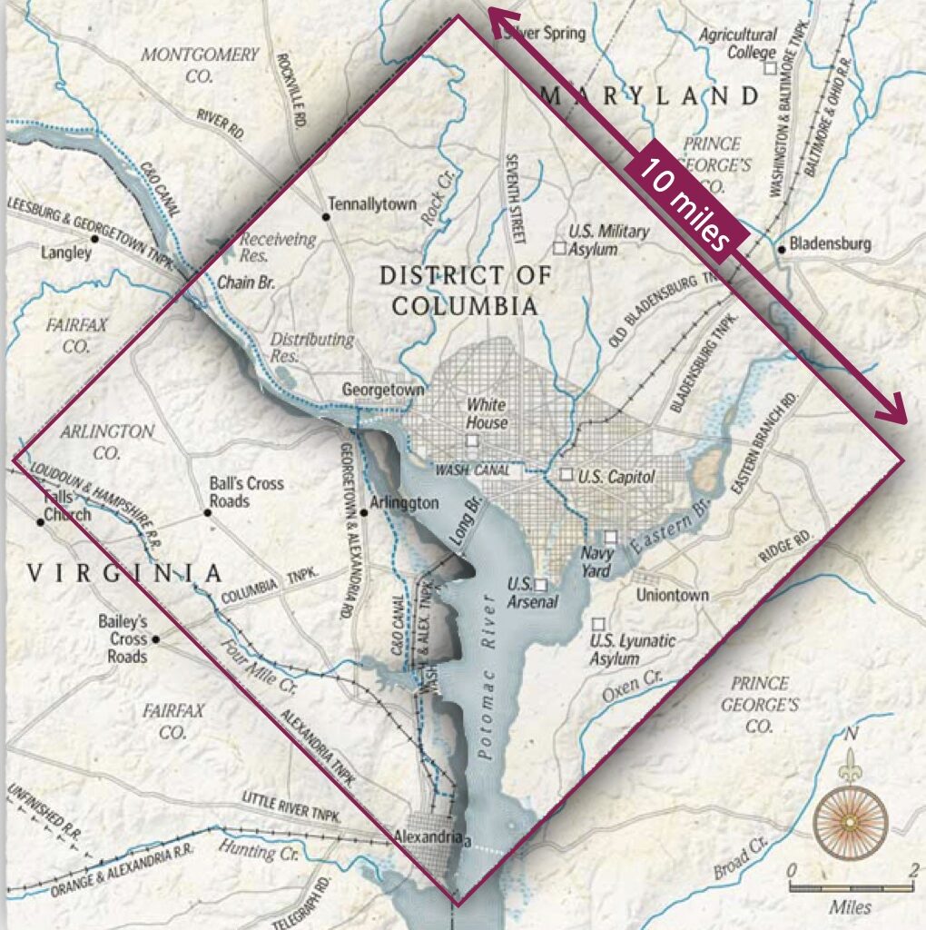
The site George Washington chose was a diamond-shaped area equal to 100 square miles.
Approx. 70 square miles would be taken from Maryland and 30 square miles from Virginia. (Va. later took its portion back.)
This 100 square mile area would be called the Federal District – . It was later renamed District of Columbia, after Christopher Columbus.
The 100 square miles chosen by George Washington included the hamlets of Alexandria (Va.) and Georgetown (Md.). The rest was farmland, woods or marsh.
A capital city would need to be created from scratch. To design this new city, Washington chose a French artist from Paris, Pierre L’Enfant.
Designing the City

He arrived in 1777 at the age of 23, and served as a military engineer in the Continental Army with Major General Lafayette. Despite his aristocratic origins, L’Enfant closely identified with the United States and changed his his first name from Pierre to Peter. L’Enfant served on General George Washington’s staff at Valley Forge.
In 1779 L’Enfant was wounded at the Siege of Savannah. He recovered but became a prisoner of war when the Americans surrendered Charleston, South Carolina, He was exchanged in November 1780 and served on General Washington’s staff for the remainder of the American Revolution. L’Enfant was promoted by brevet to Major in the Corps of Engineers on May 2, 1783, in recognition of his service to the cause of American liberty. He was discharged when the Continental Army was disbanded in December 1783.
L’Enfant also designed furniture and houses for the wealthy, as well as coins and medals, including the Purple Heart.
L’Enfant also designed furniture and houses for the wealthy, as well as coins and medals, including the Purple Heart.
Enfant arrived in Georgetown on March 9, 1791, and began his work. Washington arrived later on March 28, to meet with L’Enfant and the Commissioners for several days.[26]
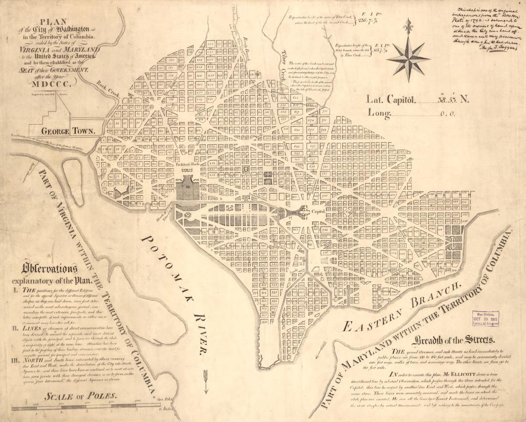
L’Enfant’s “Plan of the city intended for the permanent seat of the government of the United States…”\ specified locations for two buildings, the “Congress House” (the United States Capitol) and the “President’s House” (known after its 1815–1817 rebuilding and re-painting of its stone walls, as the “White House” or “Executive Mansion”).[31]
The “Congress House” would be built on “Jenkins Hill” (later to be known as “Capitol Hill”), which L’Enfant described as a “pedestal awaiting a monument”.[31][35] The “President’s House” would be located at a northwest diagonal from the “Congress House” along the future Pennsylvania Avenue.[22][31] The “President’s House” would be situated on a ridge parallel to the Potomac River, north of a riverfront marsh and a canal (known as “Tiber Canal” or the “Washington City Canal” during the 1800s).
L’Enfant envisioned the “President’s House” to have public gardens and monumental architecture. Reflecting his grandiose visions, he specified that the “President’s House” would be five times the size of the building that was actually constructed, even then becoming the largest residence then constructed in America.
The plan specified that most streets would be laid out in a grid. To form the grid, some streets (later named for letters of the alphabet) would travel in an east–west direction, while others (named for numbers) would travel in a north–south direction. Diagonal broader avenues, later named after the states of the Union, crossed the north–south-east/west grid. The diagonal avenues intersected with the north–south and east–west streets at circles and rectangular plazas that would later honor notable Americans and provide open space
L’Enfant laid out a 400 feet (122 m)-wide garden-lined “grand avenue”, which he expected to travel for about 1 mile (1.6 km) along an east–west axis in the center of an area that would later become the National Mall.[38][40] He also laid out a narrower avenue (Pennsylvania Avenue) which would connect the “Congress House” with the “President’s House”.[30][38] In time, Pennsylvania Avenue developed into the capital city’s present “grand avenue”.

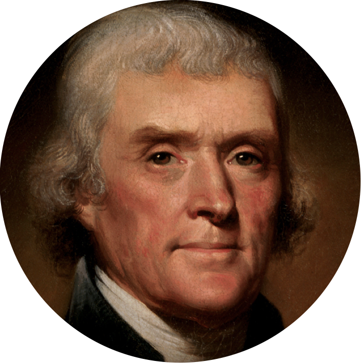
Thomas Jefferson
What was the Compromise of 1790?
Madison and Jefferson wanted the capital to be in the southern part of the country., but they lacked a majority to pass the measure through Congress. Meanwhile, Hamilton was pushing for Congress to pass the Assumption Bill which would allow the Federal government to assume the outstanding debts accumulated by the northern states during the American Revolution. With the compromise, Hamilton would deliver the necessary votes from the New York State congressional delegation for the Potomac site, while Madison would round up support from for the southern states for Hamilton’s Assumption Plan.

